Jul 2, 2025
Powerful Low-Pressure System Batters Eastern Australia
A formidable low-pressure system is currently sweeping across eastern Australia, unleashing heavy rain, strong winds, and dangerous surf conditions. While some relief is starting to show, the weather event is far from over, with rough conditions expected to continue for several more days. Here’s an in-depth look at the situation, its impact, and what to expect in the coming days.
Table of Contents
- Current Weather Overview
- Rainfall and Wind Impact
- Outlook: Winds, Waves, and Beach Conditions
- Summary of Key Points
- Frequently Asked Questions
Current Weather Overview
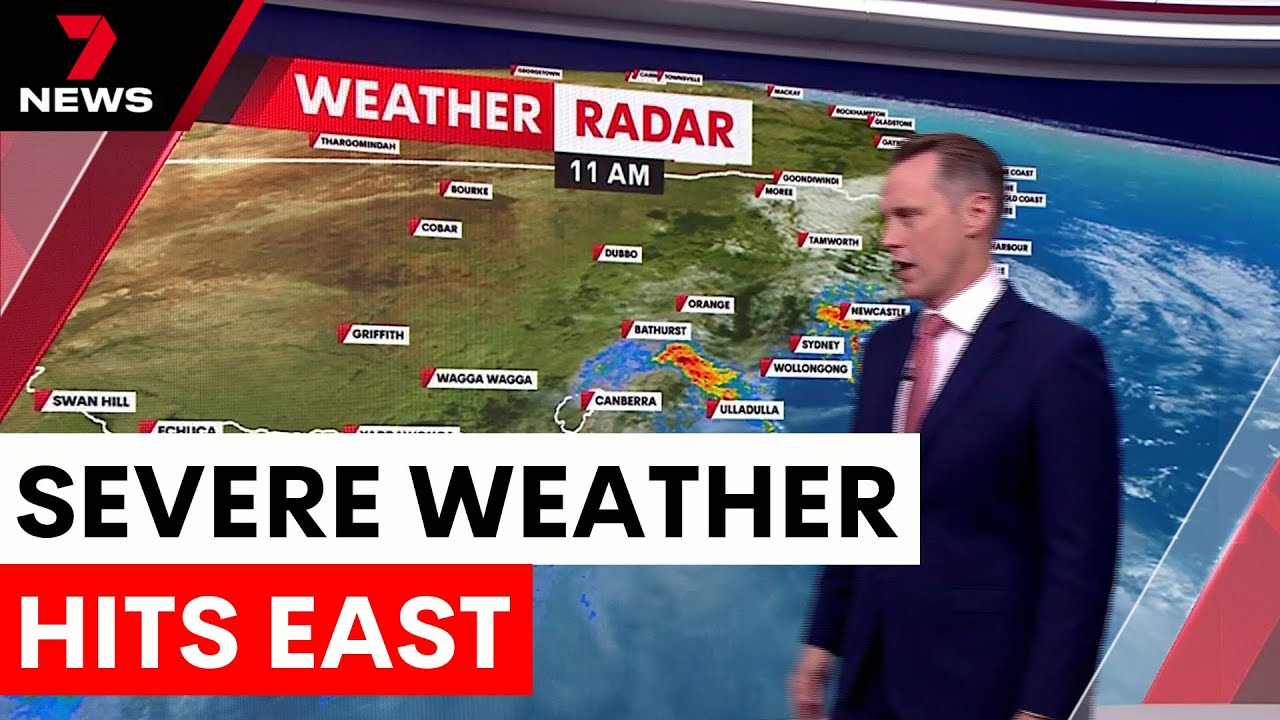
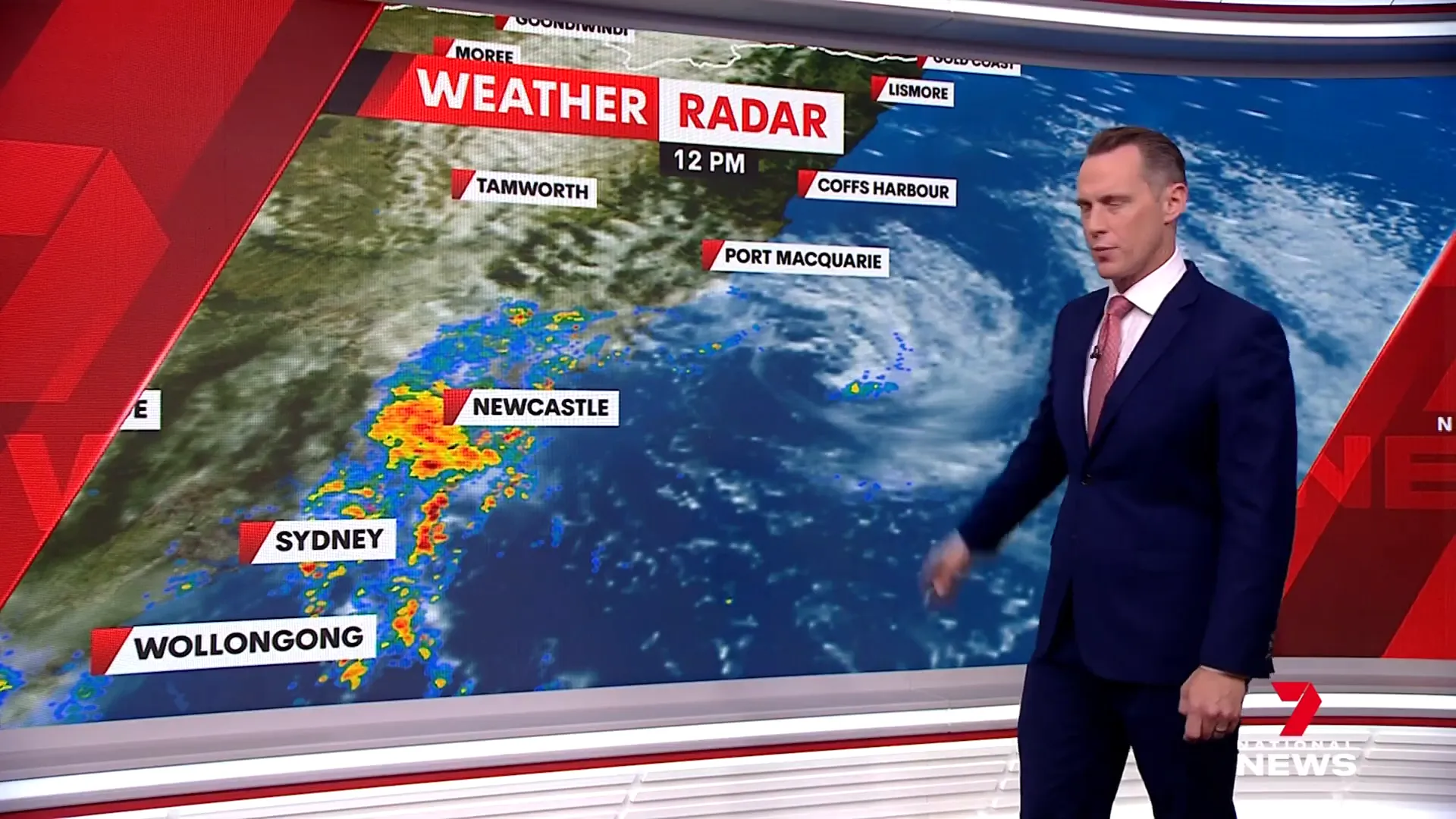
The low-pressure system has been a dominant force across the eastern coast, particularly affecting New South Wales and parts of southeastern Queensland and Victoria. This impressive spiraling low has been tracked moving northward past Newcastle this morning and is now closer to Port Macquarie, continuing to push away from the coastline.
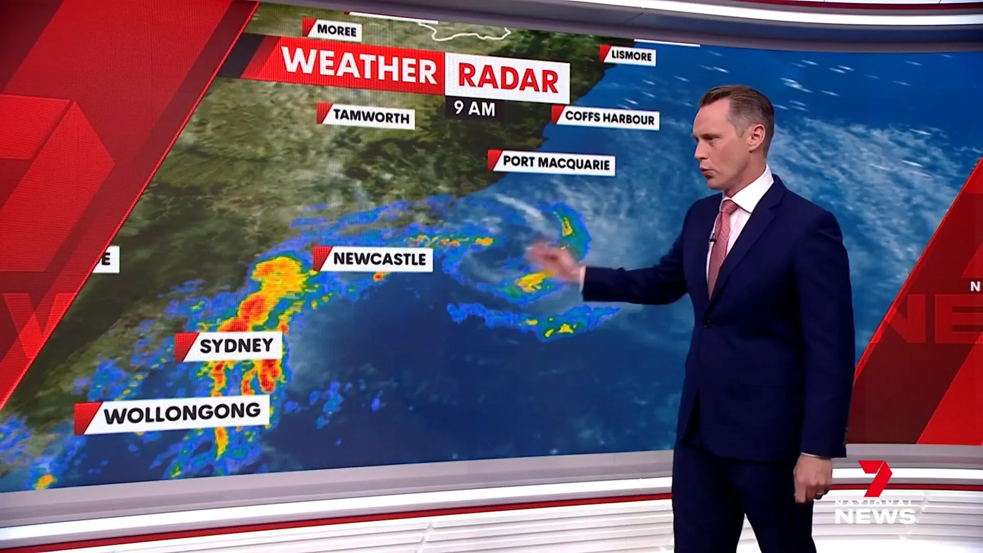
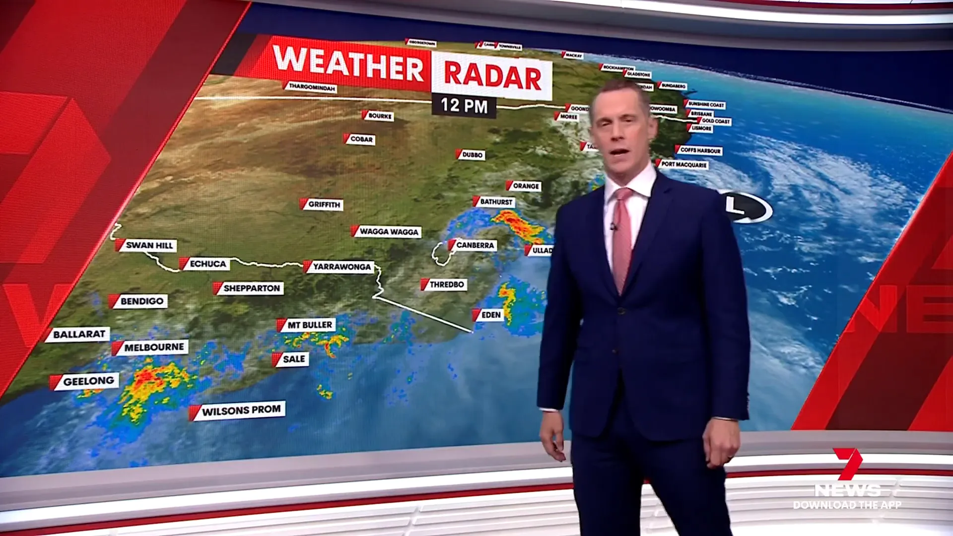
Despite the system moving away from the coast, there remain pockets of heavy rainfall. Notably, areas between Sydney and Newcastle are still experiencing significant downpours. Another belt of rain is extending between Jervis Bay and Bathurst, while eastern Victoria is also seeing persistent rainfall.
Rainfall and Wind Impact
Some southern parts of New South Wales have recorded substantial rainfall totals, with up to 260 millimeters falling over the past couple of days. This has contributed to saturated grounds and heightened flood risks in these regions.
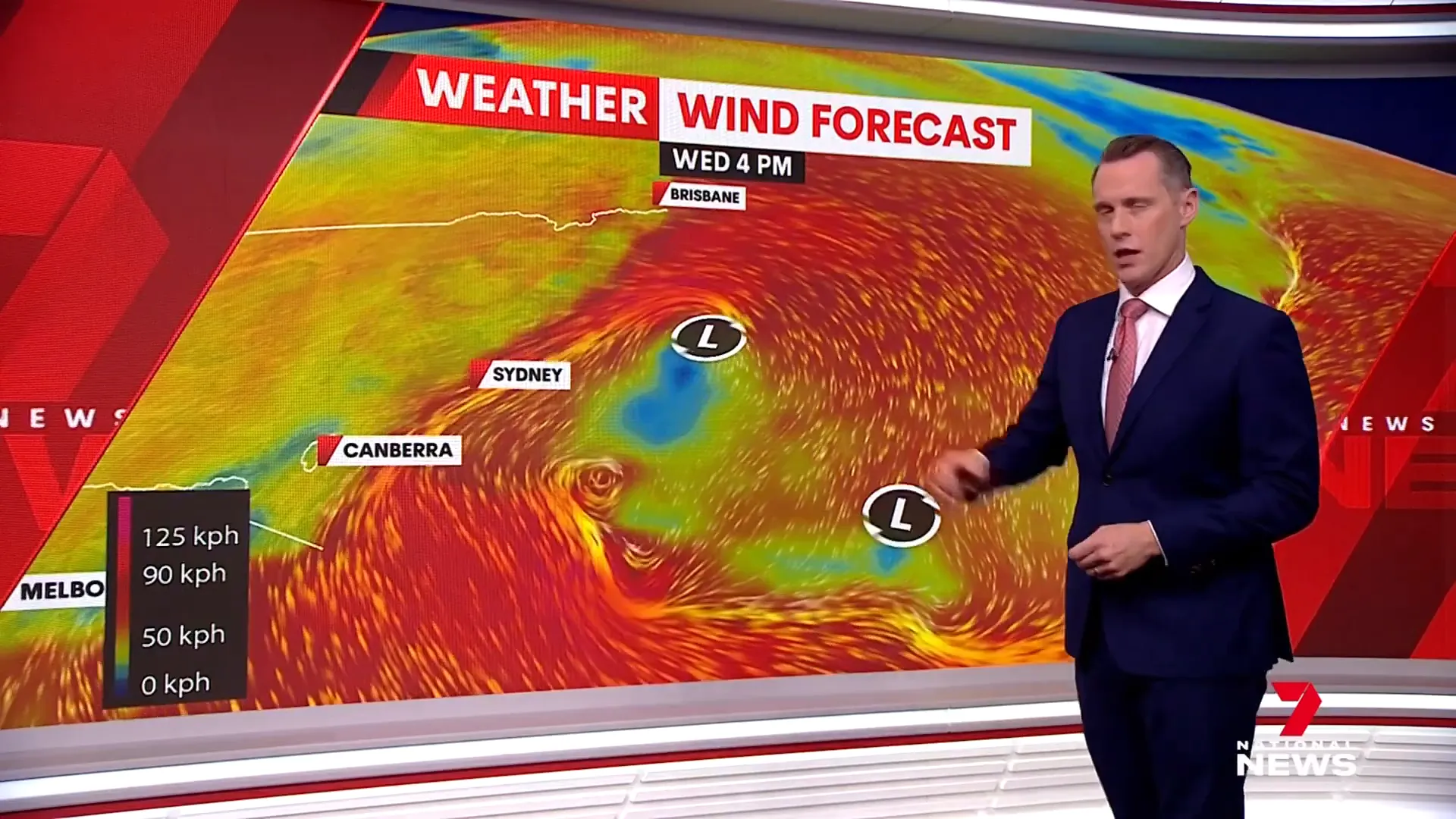
While the heavy rain is expected to gradually ease tonight and into tomorrow, the winds remain a significant concern. Strong gusts continue to be recorded, particularly in Northern New South Wales and Southeast Queensland. These gusts are driven by the low-pressure system as it flings air upward, sustaining turbulent conditions.
Outlook: Winds, Waves, and Beach Conditions
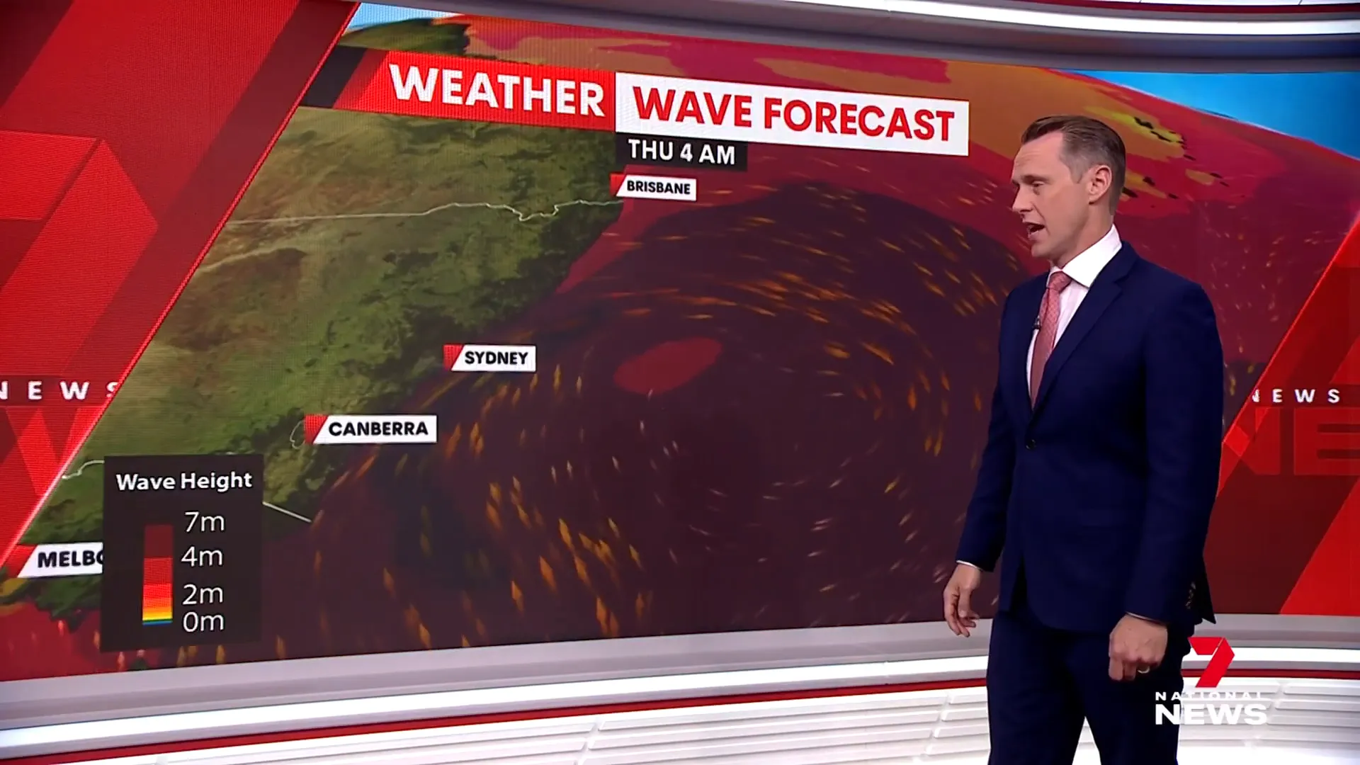
The wind is forecasted to gradually ease tomorrow, with a more pronounced decrease expected on Friday. However, the waves and surf conditions will remain rough for at least another day. Beachgoers should exercise caution, as hazardous surf and strong currents could persist through to the weekend.
Eventually, from Friday into the weekend, calmer conditions are anticipated, allowing for safer coastal environments. Nevertheless, residents and visitors should remain vigilant and heed any official weather warnings or advice.
Summary of Key Points
- The low-pressure system is moving northward, away from the coast but still causing heavy rain and strong winds.
- Rainfall totals have reached up to 260 millimeters in parts of southern New South Wales.
- Heavy rainfall pockets persist between Sydney and Newcastle, and between Jervis Bay and Bathurst, with rain also impacting eastern Victoria.
- Strong wind gusts continue in Northern New South Wales and Southeast Queensland, expected to ease by Friday.
- Rough surf and beach conditions will last through the weekend before improving.
Frequently Asked Questions
Is the heavy rain expected to continue?
The heavy rain is beginning to ease and is forecast to taper off tonight and tomorrow. However, some pockets of rain will persist during this period.
How strong are the winds currently?
Strong gusts are still being recorded, especially in Northern New South Wales and Southeast Queensland, driven by the low-pressure system. Winds are expected to gradually ease by tomorrow and drop more significantly by Friday.
Are there any flood warnings in place?
While the article does not specify current flood warnings, the substantial rainfall totals—up to 260 millimeters—indicate a heightened risk. Residents should monitor local authorities for flood warnings and updates.
When will beach and surf conditions improve?
Beach and surf conditions will remain rough for at least another day but are expected to improve from Friday into the weekend, allowing for safer coastal activities.
Which areas are most affected by this weather system?
Southern parts of New South Wales, including areas between Sydney and Newcastle, Jervis Bay to Bathurst, as well as eastern Victoria and parts of Southeast Queensland, are most impacted by the heavy rain and strong winds.